Driving PCH North to South
PACIFIC COAST HIGHWAY • CALIFORNIA HIGHWAY 1 • BIG SUR
The coast is on your right. The turnouts line up with the direction. And Big Sur is better experienced when the road itself stays part of the view.
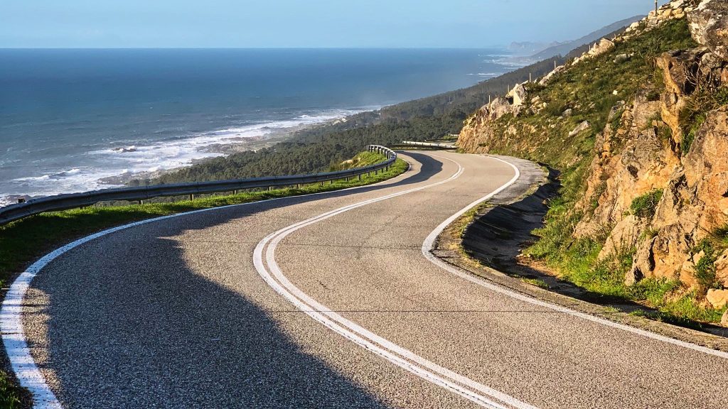
Driving PCH north to south changes the way the coast sits beside you. On the classic California Highway 1 journey from the San Francisco area toward Los Angeles, the southbound direction generally puts the Pacific on your right : thus the ocean side of the highway. That matters because the road itself is the attraction
My strongest reason for refusing the south-to-north version is practical rather than dramatic: through the Big Sur section, the ocean is on the opposite side when you travel northbound, while a Monterey County planning study found that many potential slow-vehicle turnout locations were on the southbound, ocean side of Highway 1. The same study identified 40 potential turnout opportunities in addition to five existing turnouts. Those are planning findings, not a promise that every turnout is open or suitable today.
There is one important qualification. I would not rearrange an entire California vacation merely to force a direction. Flights, hotels, rental-car arrangements, weather and road restrictions can all make south-to-north the practical choice. But when the trip is specifically about experiencing PCH as a coastal road, I choose north to south.
Why I Choose PCH North to South
The strongest argument for driving Highway 1 north to south is not that the scenery suddenly becomes better. The coast is spectacular in both directions. However, the difference is your position on the road.
Ok look here, California drives on the right. Along the classic Big Sur coastline, the Pacific lies west of Highway 1. Travel south and the ocean is generally to your right. Travel north and the ocean is generally to your left.
That sounds like a small thing until you spend hours on a road where the landscape repeatedly opens toward the sea. The view is not just a destination you reach at a lookout. It appears beside the vehicle, disappears behind a curve and then returns again.
There is also a practical road-management reason for my preference. A local study on Highway 1 in Big Sur found 5 official slow-car pull-offs and 40 potential new spots mostly on the ocean (southbound) side. It warns that informal, makeshift roadside stops are often too narrow, steep, or bumpy to safely use as real turnouts.
So my argument is narrower than “southbound is better.” It is this: when I want the ocean beside me and I want legitimate southbound-side stopping opportunities aligned with my direction of travel, north to south makes more sense to me.
It is about the road position, not a claim of universal superiority
I would not tell a traveler that north-to-south is automatically safer. Highway 1 is a demanding road in either direction. Caltrans reduced the speed limit from 55 mph to 45 mph on a 5.1-mile Big Sur segment in 2026, and the change applies in both directions. Curves, grades, visibility, traffic, cyclists, road work and changing weather remain relevant whichever way you drive.
The reason I still choose southbound is simpler: when I pay extra time for a coastal highway, I want my driving position to keep the ocean as part of the forward-looking experience rather than placing it behind the passenger side of my travel plan.
San Francisco → Los Angeles: Three Ways to Make the Journey
For this RoadBlueprint comparison, the common Start A is the San Francisco area and the common Final Destination B is the Los Angeles area. The three routes below are genuine alternatives: one prioritizes speed, one uses the central PCH experience and then returns to U.S. 101, and one stays on the coastal corridor for the fullest north-to-south Highway 1 experience.
Distances and driving times below are planning baselines rather than live navigation quotes. Use the Google Maps buttons for your exact departure time and Caltrans for road conditions.
Route 1 — FASTEST: U.S. 101
Main gain: speed and simplicity. Main sacrifice: this is not the classic PCH coastal experience through Big Sur.
Route 2 — MODERATELY FAST: PCH to San Luis Obispo, then U.S. 101
Main gain: the essential Big Sur experience without keeping the coastal road for the entire southern leg. Main sacrifice: you leave Highway 1 before the Morro Bay–Malibu section.
Route 3 — SLOWEST / MOST SCENIC: Full PCH North to South
Main gain: the road itself stays central almost all the way to Los Angeles. Main sacrifice: time. This route should be treated as a multi-day road trip, not a one-day commute.
PCH Road Status: The Part You Must Recheck
Official status snapshot: September 26, 2026. Caltrans reports that Highway 1 is currently open in the Southern California area with no traffic restrictions reported there. In the Central California area, Caltrans lists 24/7 one-way controlled traffic 15.7 miles south of Monterey at Rocky Creek Bridge through 6:00 a.m. on November 30, 2026 because of construction. Caltrans also lists one-way control on SR 1 in Marin County through October 16, 2026, plus other northern work zones.
Big Sur: Highway 1 is not shown as closed in the current Caltrans road-information snapshot, but the Rocky Creek Bridge has 24-hour one-way traffic control because of construction.
Southern California: Caltrans currently reports no traffic restrictions in its Southern California SR 1 area listing.
Important: construction and emergency conditions can change. Check again immediately before the drive and again before the Big Sur leg.
Park status can be different from highway status
This distinction matters in September 2026. California State Parks currently lists Pfeiffer Big Sur State Park as closed due to the Timber Fire. Julia Pfeiffer Burns State Park is listed as partially open, while backcountry trails east of Highway 1 remain closed because of fire suppression and repair work. Other Big Sur parks have their own restrictions.
So a traveler can have a road that is open to through traffic while a famous park, trail or facility beside that road is closed or restricted. Never use “Highway 1 is open” as a substitute for checking the attraction you actually intend to visit.
PCH North-to-South Map
Use the map for geographic orientation and the directions link for trip planning. Google Maps can help calculate a route for a specific departure time, while Caltrans remains the official source for California highway status.
Orientation map centered on the Big Sur section. Open the route directions for a live multi-stop driving plan.


Gallery is for visual orientation. Formal attribution and licence details are listed in Image Credits below. The slides are not clickable.
Route 1 — Fastest: U.S. 101
This is the route to choose when the coastline is not the primary reason for the drive. U.S. 101 keeps you moving south through the interior side of the California coast, then returns you to the Santa Barbara and Los Angeles corridor.
Route 1 — One-Day Transit Plan
7:00 a.m. Depart the San Francisco area.
Late morning: Use the Salinas/King City corridor for fuel, restrooms and a proper walk.
Early afternoon: Continue through Paso Robles and south on U.S. 101.
Late afternoon: Reach Santa Barbara if traffic allows. From there, the road becomes increasingly urban on the approach to Los Angeles.
Evening: Arrive in Los Angeles only if the driver still has adequate energy. Otherwise, turn the route into a two-day trip.
RoadBlueprint road moment: If you chose this route because you need the fastest practical connection, do not feel guilty about skipping PCH. U.S. 101 is serving a different purpose.
Route 2 — Moderately Fast: PCH Through Big Sur, Then U.S. 101
This is my compromise route. You still get the central coastal section that makes the north-to-south argument so compelling: Monterey, Carmel, the Big Sur cliffs, Bixby Bridge and the San Simeon area. Then, rather than insisting on the coastal road for every remaining mile, you move onto U.S. 101 south of the Central Coast.
Route 2 — 3-Day Itinerary
Day 1 — San Francisco to Monterey/Carmel
Depart early and use the first part of the day to reach the Monterey Peninsula. Keep the afternoon for Carmel or Point Lobos rather than trying to push all the way through Big Sur.
Day 2 — Monterey/Carmel through Big Sur to San Simeon
This is the day to slow down. Build the route around the road itself, Bixby Bridge, carefully selected legal stopping areas and the current park conditions around Julia Pfeiffer Burns and other Big Sur sites.
Day 3 — San Simeon to Los Angeles
Use the faster corridor after San Luis Obispo. This is where the hybrid route earns its name: you experienced the signature coast without spending the entire trip on the slower road.
RoadBlueprint road moment: When you leave Highway 1 for U.S. 101, you are not “quitting” the road. You are changing the purpose of the next leg—from scenery-first driving to efficient southbound travel.
Route 3 — Slowest / Most Scenic: Full PCH North to South
This is the route I would choose when the phrase Driving PCH North to South is the actual trip objective. You are not simply using Highway 1 to get somewhere else. You are using the highway as the trip.
Route 3 — 4-Day Itinerary
Day 1 — San Francisco to Monterey/Carmel
Leave the San Francisco area in the morning. If conditions permit, use Santa Cruz as a short coastal reset, then continue to Monterey and Carmel for the night.
Day 2 — Carmel to Big Sur and San Simeon
This is the heart of the journey. Take the southbound ocean-side position seriously: stay alert, use legitimate turnouts, allow for the Rocky Creek traffic control and do not build the day around ten-minute photo stops at every mile.
Day 3 — San Simeon to Santa Barbara
Give yourself time around San Simeon, Cambria and the Central Coast before continuing south. If the schedule allows, use Morro Bay as a longer lunch or walking break before reaching Santa Barbara.
Day 4 — Santa Barbara to Malibu and Los Angeles
This final leg becomes more developed. Leave enough time for urban traffic and avoid treating Malibu as if it were the same road environment as Big Sur.
RoadBlueprint road moment: There is a point on a good southbound PCH day when you stop thinking about the next attraction and simply watch the coastline change. That is the part no mileage table can measure.
Big Sur Is Where the Direction Argument Becomes Real
Big Sur is the section that makes the north-to-south argument more than a slogan. The Santa Lucia Mountains rise sharply above the Pacific, and Highway 1 repeatedly moves between forested curves and exposed coastal views. Caltrans currently treats the road as a working transportation corridor, not a theme-park ride. In April 2026, the agency reduced the speed limit on a 5.1-mile section to 45 mph in both directions after an engineering and traffic survey. The affected stretch runs from south of Coast Road to north of Garrapata Creek Bridge.
Focus on the road ahead. Watch for sharp turns, bicyclists, roadwork, or new lane patterns before looking at the scenery. Slow down before you reach the view, not while you are looking at it.
Bixby Creek Bridge
Bixby Creek Bridge is one of the unmistakable structures of the Big Sur coast and sits directly on California State Route 1. It is also one of the easiest places for a beautiful view to become a parking problem.
Approach slowly, watch other traffic and use only appropriate designated stopping areas. Never stop in the travel lane just because another car has already done it.
McWay Falls
McWay Falls is one of the signature sights associated with Julia Pfeiffer Burns State Park. However, this is not a “drive past and assume it is open” stop. The park currently has restrictions linked to wildfire suppression and repair work.
California State Parks currently lists Julia Pfeiffer Burns as partially open, while backcountry trails east of Highway 1 remain closed. Check the official park notice before assuming the exact trail or viewing area you want is available.
Pfeiffer Big Sur State Park
Do not confuse the park name with the highway. As of September 26, 2026, California State Parks lists Pfeiffer Big Sur State Park as closed because of the Timber Fire. That closure does not mean the entire Highway 1 corridor is closed.
This is exactly the kind of distinction a serious road-trip article should make: the road can be open while an attraction beside the road is not.
Stops I Would Prioritize on the North-to-South Drive
You do not need thirty viewpoints. The road itself deserves time, and a handful of strong stops are easier to enjoy than a checklist that forces you to keep watching the clock.
San Francisco
Use the city as the starting point rather than trying to count it as a PCH scenic stop. If you cross the Golden Gate, treat the bridge as the symbolic beginning and then settle into the southbound road.
Monterey & Carmel
This is the sensible preparation zone before Big Sur. Use it for food, fuel, restrooms and a final schedule check.
Point Lobos
A strong coastal stop near Carmel when open and when your schedule allows a proper walk rather than a rushed photograph.
Bixby Bridge
One of the signature Big Sur landmarks. Treat the surrounding road and traffic as seriously as the view.
McWay Falls Area
Check current Julia Pfeiffer Burns State Park conditions before you plan this as a stop.
Hearst San Simeon
Useful for a longer Central Coast stop and a natural transition away from the tightest Big Sur terrain.
Santa Barbara
A good place to let the trip breathe before the increasingly urban southern coastal corridor.
Malibu
Beautiful coastline, but a completely different driving environment from remote Big Sur. Plan for traffic and urban road behavior.
Point Lobos: the optional early walk
California State Parks currently lists Point Lobos State Natural Reserve day-use hours as 8:00 a.m. to 7:00 p.m., with last entry at 6:30 p.m. That makes it a useful flexible stop for travelers who have protected enough time around Monterey and Carmel.
Hearst San Simeon: the longer Central Coast stop
Hearst San Simeon State Historical Monument is open daily, according to California State Parks, with daytime tours beginning at 9:00 a.m. and the last daytime tour currently listed at 3:20 p.m., subject to schedule changes. This is the sort of attraction that deserves a protected appointment in your day rather than being treated as an accidental roadside stop.
North to South vs. South to North
The table below describes the road-position difference. It is not a scientific ranking and it is not claiming that one direction is universally better for every traveler.
| Planning factor | North to South | South to North |
|---|---|---|
| Ocean position | Generally ocean-side through the classic Big Sur section. | Generally inland-side through the same section. |
| Southbound turnout alignment | Many potential turnout locations identified in Monterey County planning were on the southbound, ocean side. | Those same southbound-side locations are on the opposite side of travel. |
| Coastal view rhythm | The Pacific is generally immediately to the right on the southbound coastal section. | The Pacific is generally to the left. |
| Scenic stop strategy | Ocean-side stopping opportunities can be naturally aligned with your travel direction when legally available. | You may need to continue to an appropriate stopping area rather than stopping at a tempting opposite-side shoulder. |
| Driving conditions | Curves, cliffs, construction, weather, traffic, cyclists and road controls affect both directions. | |
| Trip logistics | Convenient when the wider itinerary moves toward Los Angeles. | Practical when your itinerary naturally starts in Southern California. |
When South to North Actually Makes Sense
I have a strong preference, but I do not worship it.
If your flight lands in Los Angeles and your rental car has to return in San Francisco, south-to-north is simply the natural itinerary. The same applies when your hotel plan, family schedule or road conditions make the reverse direction easier.
In that situation, I would not spend money, time or energy rebuilding the entire trip around a directional preference. You are still driving one of California’s great roads. You are simply experiencing its coastal side from the opposite direction.
The distinction is worth knowing because it prevents a common mistake: turning a useful road-planning idea into an absolute rule.
When Is the Best Time to Drive PCH?
There is no single perfect month. The more reliable rule is to choose the season you prefer and then check the current road and park conditions immediately before travel.
Late spring through early fall
Longer daylight gives you more room for scenic stops. However, coastal fog can still reduce visibility, and busy weekends can make parking and traffic more complicated than an ordinary weekday.
Winter and early spring
This is when I would build the loosest schedule. Heavy rain can contribute to rockfall, landslides, flooding and other road problems along the California coast. A perfect-looking forecast is not permission to ignore the road-information system.
Never give Big Sur only enough time to cover the Google Maps ETA. Leave a buffer for traffic controls, legal scenic stops, weather and the possibility that your “quick photo” becomes twenty minutes.
How Many Days Should You Give the Drive?
If your purpose is simply to get from San Francisco to Los Angeles, U.S. 101 can do that far more efficiently. If your purpose is to experience PCH, the number of days should increase because stopping is part of the point.
1 Day
Possible as a pure transit drive, but not the way I would plan a scenery-first PCH experience.
2 Days
Enough for a fast coastal taste if you keep stops disciplined and use a hybrid route.
3 Days
A workable balance for San Francisco, Monterey/Big Sur and a Central Coast or Santa Barbara finish.
4+ Days
The best fit for travelers who want the coast to remain the main event all the way to Los Angeles.
The Road Moment: When the Coast Suddenly Opens
There is a rhythm to Highway 1 that a distance figure cannot explain.
You spend part of the drive watching the lane and the curve ahead. Then the trees fall away, the Pacific appears, and the road seems to hang between mountain and ocean for a few seconds.
That is the reason I prefer the southbound direction.
Not because northbound travelers are missing California. Not because every southbound view is better. The attraction is that the ocean sits on the side of the vehicle where I want the landscape to live, and the coastal road becomes part of the experience rather than merely the connector between attractions.
Practical PCH Rules I Would Not Break
Check Caltrans
Check current Highway 1 conditions before leaving and again before the Big Sur leg.
Use Legal Turnouts
A beautiful view is not a parking space. Use signed or otherwise appropriate stopping areas.
Respect the Curve
Slow before the bend and stay focused on the lane. Do not brake suddenly just because the ocean appears.
Protect the Day
Leave buffer time. A road trip built to the minute becomes fragile the moment traffic or construction changes.
Check Park Status
Highway access and attraction access are different questions.
Refuel Early
Use larger communities and convenient fuel opportunities rather than gambling on the next station.
- Do not stop in a travel lane.
- Do not assume every shoulder is a legitimate turnout.
- Do not chase a photograph across opposing traffic.
- Do not assume an attraction is open because the highway is open.
- Do not let a Google Maps ETA become your safety plan.
Google Maps Is for Planning; Caltrans Is for Road Status
Google Maps is excellent for seeing how San Francisco, Monterey, Big Sur, San Simeon, Santa Barbara, Malibu and Los Angeles connect. It is also useful for adjusting your route when you change your departure time or add a stop.
But a standard Google Maps route estimate should not be treated as official proof that Highway 1 is open. Caltrans maintains the official road-information system and QuickMap for California highway conditions.
RoadBlueprint Traveler Scorecard
These are RoadBlueprint editorial planning scores, not scientific measurements. They describe how the route may fit different travel styles; they are not claims that one traveler type is more important than another.
❤️ Love / Romance
👨👩👧👦 Family Reunion
🧒 Happy Kids
🤝 Finding New Friends
RoadBlueprint Travel Snapshot
What You Will Enjoy
- The Pacific generally sits on the ocean side of the vehicle through the classic southbound Big Sur direction.
- Many potential turnout sites identified in Monterey County planning were on the southbound, ocean side.
- The route changes from city to coastal peninsula to mountain-and-ocean driving and finally to the urban Southern California coast.
- You can build a trip around the road itself instead of collecting every possible attraction.
- North-to-south naturally aligns with an itinerary that finishes in the Los Angeles area.
What You May Miss or Sacrifice
- You spend more time driving than you would on U.S. 101.
- Construction controls can affect your arrival time.
- Some famous parks or trails may be restricted independently of highway access.
- Coastal fog can obscure views even on a carefully chosen date.
- A scenery-first route requires more patience with slow traffic and more time for legal stops.
Why I Would Not Turn This Into a South-to-North Driving Test
The best road trip is not the one that obeys a slogan most perfectly. It is the one that fits the actual trip.
So even though this article is titled “Why I Refuse to Drive It South to North,” I would break my own rule when the itinerary demands it. The title describes my preference when direction is under my control, not a commandment for everybody else.
What I would not do is drive south to north and then spend the whole trip wishing I were going the other way. Decide before you leave what matters more: ocean-side positioning or overall itinerary convenience.
The Bottom Line: Why I Choose North to South
Driving PCH north to south gives me the road position I want. Through the classic Big Sur section, the Pacific stays on the ocean side of the vehicle, and Monterey County planning evidence supports the practical relevance of southbound-side turnout opportunities.
That is enough for me.
I would rather slow down beside the Pacific, leave room for the road to surprise me, and finish in Los Angeles than reverse the experience simply because a different itinerary happens to be more common.
And if circumstances force me to drive north? I will still take the road carefully, enjoy the coastline and get on with the trip.
Frequently Asked Questions
Is it better to drive PCH north to south?
If your priority is the classic ocean-side Highway 1 experience through Big Sur, north to south has a practical road-position advantage. The Pacific is generally on the right side of the vehicle, and Monterey County planning identified many potential turnout locations on the southbound, ocean side.
Why do people recommend driving Highway 1 north to south?
The most practical reason is road position. Southbound travel generally keeps the Pacific on the ocean side of the vehicle through the classic Big Sur section. It can also align more naturally with southbound-side stopping opportunities.
Is PCH south to north dangerous?
The direction alone should not be described as making the trip dangerous. Highway 1 can be demanding in either direction because of curves, grades, weather, traffic, construction and changing road conditions.
Is Highway 1 through Big Sur open right now?
As of the September 26, 2026 Caltrans snapshot, Highway 1 is not listed as closed through Big Sur, but one-way traffic control is operating 24 hours a day at Rocky Creek Bridge because of construction. Recheck Caltrans immediately before travel.
Are Big Sur parks open right now?
Not all of them. California State Parks currently lists Pfeiffer Big Sur State Park as closed because of the Timber Fire. Julia Pfeiffer Burns State Park is partially open with restrictions. Check each park separately.
Can I drive PCH from San Francisco to Los Angeles in one day?
You can, but a one-day drive leaves little room for the reason most people choose the coastal road: stopping and enjoying it. U.S. 101 is the more natural one-day transit route.
What should I check before driving PCH?
Check Caltrans road conditions and QuickMap, current California State Parks notices for your planned stops, weather, fuel needs and your Google Maps route shortly before departure.
Sources & References
- California Department of Transportation. (2026). California Highway Information: State Route 1. https://roads.dot.ca.gov/?roadnumber=1
- California Department of Transportation. (2026). Caltrans QuickMap. https://quickmap.dot.ca.gov/
- California Department of Transportation. (2026, April 13). Caltrans Lowers Speed Limit on 5.1-Mile Segment of Highway 1 Along the Big Sur Coast. https://dot.ca.gov/caltrans-near-me/district-5/d5-news/d5-news-4-13-2026-2
- California Department of Transportation. (2026, May 26). Temporary Traffic Signals to Activate on Highway 1 at the Rocky Creek Bridge. https://dot.ca.gov/caltrans-near-me/district-5/d5-news/d5-news-5-26-2026
- California Department of Transportation. (2026). Big Sur Highway 1. https://dot.ca.gov/caltrans-near-me/district-5/district-5-current-projects/big-sur-highway-1
- County of Monterey. (2019). Big Sur Highway 1 Sustainable Transportation Demand Management Plan. https://www.countyofmonterey.gov/home/showpublisheddocument/115303/637987642057030000
- California State Parks. (2026). Julia Pfeiffer Burns State Park. https://www.parks.ca.gov/?page_id=578
- California State Parks. (2026). Pfeiffer Big Sur State Park. https://www.parks.ca.gov/?page_id=570
- California State Parks. (2026). Point Lobos State Natural Reserve. https://parks.ca.gov/?page_id=571
- California State Parks. (2026). Hearst San Simeon State Historical Monument. https://parks.ca.gov/?page_id=591
Image Credits
- Golden Gate Bridge — Peter Craig — Wikimedia Commons file “GoldenGateBridge.jpg” — public domain according to the file page.
- Point Lobos — Chris M Morris — Wikimedia Commons file “Point Lobos (3796721031).jpg” — CC BY 2.0.
- Bixby Creek Bridge — Thomson200 — Wikimedia Commons file “Bixby Creek Bridge, Aug 2019.jpg” — CC0 1.0.
- McWay Falls — U.S. Geological Survey — Wikimedia Commons file “McWay Falls.jpg” — CC BY 2.0.
- Hearst Castle — Proimos — Wikimedia Commons file “Hearst Castle.jpg” — CC BY-SA 3.0.
- Santa Barbara — Ken Lund — Wikimedia Commons file “Santa Barbara, California (20961832393).jpg” — CC BY-SA 2.0.
- Pacific Coast Highway Malibu — Carolineliebes — Wikimedia Commons file “Pacific Coast Highway Malibu.jpg” — CC0 1.0.