Massachusetts Road Trip
A Massachusetts road trip can be surprisingly easy to get wrong. Boston to Provincetown is about 120 miles by road, but adding Salem, Gloucester, Rockport or Cape Cod’s slower roads changes where your time goes and what the journey feels like.
The real question is not simply, “How do I get to Provincetown?” It is which parts of Massachusetts you want the road itself to give you. The direct Cape route gives you more time at the destination. A North Shore detour gives you historic waterfront towns before you reach the Cape. additionally, Route 6A gives you a slower, more traditional Cape Cod drive instead of treating the peninsula like a corridor to cross.
The Massachusetts Road Trip in One View
For this guide, the road trip starts in Boston and finishes in Provincetown. That gives you three useful ways to structure the journey: go directly across Cape Cod, build in the North Shore, or slow down once you reach Cape Cod and use Route 6A as the scenic spine.
RoadBlueprint rule: Do not confuse driving time with trip time. A route can take only a few hours to drive and still deserve an entire day once parking, walking, photographs, food and actual sightseeing are included.
Key points before you choose
- Boston → Provincetown direct: about 120 miles and roughly 2½ hours of driving before stops and traffic.
- North Shore route: adds Salem, Gloucester and Rockport, so the journey becomes a sightseeing day rather than a simple transfer.
- Route 6A: Massachusetts tourism describes Old King’s Highway as a roughly 62-mile historic scenic route through Cape Cod towns and coastal landscapes.
- Cape Cod National Seashore: the National Park Service directs Boston-area drivers toward Route 3, the Sagamore Bridge and Route 6 toward the Outer Cape.
Three Ways to Drive From Boston to Provincetown
Choose based on where you want your time to go
The three options below are not three completely different highways. They are three different ways of using your travel day. One protects destination time. Another puts the North Shore first. The third gives Cape Cod itself more attention.
Boston → Route 3 → Route 6 → Provincetown
This is the cleanest point-A-to-point-B option. The tradeoff is simple: you spend less time exploring the North Shore and more time reaching the Cape.
You enjoy: fewer planned detours, a simple navigation chain and more destination time.
You miss: Salem, Gloucester and Rockport unless you deliberately add them later.
Open Route 1 in Google MapsBoston → Salem → Gloucester → Rockport → Cape Cod
This route changes the trip from a transfer into a North Shore road day. It is useful when the towns themselves are part of the reason for taking the trip.
You enjoy: a sequence of distinct waterfront communities and more reasons to stop, walk and eat.
You miss: some of the slower Cape scenery because more of your day is spent before you reach the Cape.
Open Route 2 in Google MapsBoston → Bourne → Route 6A / Old King’s Highway → Route 6 → Provincetown
Massachusetts tourism describes Route 6A as a roughly 62-mile corridor from Bourne through Cape Cod’s historic towns, with older homes, galleries, marshes, beaches and village scenery.
You enjoy: a slower Cape drive where the towns and roadside landscape become part of the trip.
You miss: some efficiency. This is not the route to choose when the main goal is reaching Provincetown as quickly as possible.
Open Route 3 in Google MapsLive Road Logistics: Check Before You Leave
Status: A specific departure-minute road condition cannot be guaranteed in a static article. Massachusetts’ official Mass511 system provides live traffic conditions, incidents, construction information, travel times and roadway camera information.
Check immediately before departure: Mass511 live traffic and road conditions.
A road without a listed closure should not automatically be described as “clear.” Traffic, lane restrictions, crashes, work zones and bridge conditions can change after publication.
Why the bridge decision matters
For the direct Boston-to-Cape route, the National Park Service directs Boston-area visitors toward Route 3 and the Sagamore Bridge before continuing along Route 6. The official Provincetown visitor information gives the same basic Boston-to-Provincetown corridor. Once you commit to the Cape, your trip becomes more destination-focused unless you deliberately build in another detour.
Map: Boston to Provincetown
Open the full Boston → Provincetown route

North Shore Stops: Salem, Gloucester and Rockport
The North Shore route works because the stops are close enough to connect into one road day, but different enough that they do not feel repetitive. Salem gives you history and a walkable waterfront district. Gloucester shifts the mood toward a working waterfront and maritime history. Rockport is smaller and more village-like, with galleries, Bearskin Neck and Motif #1.
Salem: start with the history, not the highway
Salem is useful as the first substantial stop because it immediately turns the road trip into a place-based experience. The official Salem visitor information describes the downtown and waterfront as walkable, with historic sites, museums, restaurants, shops and Salem Maritime National Historic Site around the waterfront.
For a road trip, you do not need to “do Salem” in one giant session. Choose one historical area, walk enough to get a sense of the waterfront and town, eat, then continue north. The mistake is spending the entire day here when the Cape is also part of your plan.
Gloucester: make the waterfront your stop
Gloucester’s official HarborWalk is particularly road-trip friendly because it is designed as a free, self-guided walk through the working waterfront and downtown. The route uses 42 granite story posts, each introducing a different part of Gloucester’s maritime history and community.
Use Gloucester as your walking stop. Park once, stretch your legs, see the harbor and continue.
If you skip it: you save time, but you lose one of the clearest working-waterfront experiences between Boston and the Cape.
Rockport: the small-town pause
Rockport is where the North Shore route begins to feel noticeably slower. The town’s official points-of-interest information highlights Bearskin Neck, Halibut Point State Park and Motif #1. The central harbor area is compact enough that a short walking stop can feel worthwhile without turning into another half-day attraction marathon.

RoadBlueprint tip: Rockport is a better “wander for an hour” stop than a place to force into a rigid minute-by-minute schedule. If parking is busy, do not burn a large chunk of the day hunting for the perfect space.
The North Shore tradeoff
Salem, Gloucester and Rockport are not simply three extra attractions. They alter where your road-trip time is spent. Add them when the journey itself matters as much as Provincetown. Skip them when you want Cape Cod to receive most of your trip.
Cape Cod: Route 6 or Route 6A?
Once you are across the canal, the road trip changes again. Route 6 is the straightforward spine toward the Outer Cape. Route 6A is the slower historic corridor known as Old King’s Highway.
Route 6: the practical spine
If your goal is to reach the Outer Cape, Cape Cod National Seashore, and Provincetown with minimal detours, Route 6 is the way to go. The National Park Service includes it in its Boston-area directions to the seashore, and it’s the logical choice when time is a factor. The problem isn’t the road itself, it’s what you might miss by viewing Cape Cod as just a passageway rather than a destination.
What about Route 6A: the road-trip version of Cape Cod
Massachusetts tourism describes Old King’s Highway as Route 6A from Bourne to Provincetown at roughly 62 miles. The route passes through or connects with historic Cape towns including Sandwich, Barnstable, Yarmouth and Dennis. It is associated with historic homes, galleries, marshes, beaches and Cape character.
That makes 6A especially useful when you want the drive itself to be part of the story. It is slower, but the slower pace is the point.
A practical hybrid: Route 6A, then Route 6
You do not have to choose one road for the entire Cape. A workable road-trip structure is to enter via Bourne, enjoy a section of Route 6A through the historic Cape towns, then rejoin Route 6 when you want a more direct run toward the Outer Cape and Provincetown.
Cape Cod National Seashore: Where the Road Becomes the Destination
Cape Cod National Seashore stretches along the Atlantic-facing side of Cape Cod. The National Park Service directs visitors toward Route 6 and the Outer Cape. Most park features are off Route 6, so expect short park-road turns and walking stops rather than one single roadside viewpoint.
Current conditions: The NPS conditions page currently lists Race Point Beach, Coast Guard Beach, Nauset Light Beach, Marconi Beach, Head of the Meadow Beach and Herring Cove Beach as open, with specific services varying by location and season.
Visitor centers: The current NPS page lists Salt Pond Visitor Center and Province Lands Visitor Center services at 9:00 AM–5:00 PM when operating.
Trails: The current NPS page lists all eleven walking trails and all three bike trails as open, while also noting seasonal and location-specific rules.
Important: Conditions can change. Beach conditions, weather, tides, ORV access and seasonal services should be checked again immediately before travel.
Do not treat the national seashore as one stop
The seashore is better thought of as a sequence of places: visitor centers, beaches, dunes, trails and overlooks. The National Park Service notes that cellular coverage can be spotty in parts of the seashore, so download important directions before heading into areas where you expect weak reception.
Race Point: the northern finish-line feeling
Race Point Beach is at the end of Race Point Road in Provincetown. The National Park Service identifies it as the northernmost point on Cape Cod and lists beach access, scenic views and seasonal services among its amenities.

There is a useful road-trip rhythm here: park, walk across the dunes, spend some time at the beach, then continue into Provincetown. That is more realistic than trying to squeeze another long list of attractions into the same block of time.
Provincetown: Do Not Rush the Finish
Treat Provincetown as the destination
Provincetown works differently from a roadside attraction. It is a destination town. Once you arrive, the value of stopping the car and walking becomes greater than trying to keep sightseeing by vehicle.
Give the final hours some breathing room
For the final part of your trip, give yourself enough time to get settled, walk the town and head toward the water or dunes without constantly checking the clock. The journey has already done its job by getting you to the Outer Cape. There is no prize for turning the final few hours into another driving session.
What the Road Actually Feels Like
Boston → North Shore
The trip starts urban and quickly becomes a sequence of smaller coastal communities. Traffic and parking become more important than raw mileage once you start entering town centers.
North Shore → Cape
This is the major commitment point. Once you turn the day toward the Cape, you are spending road-trip time to reach another large destination area rather than simply hopping between towns.
Bourne → mid-Cape
This is where Route 6A can change the rhythm completely. The road is more about town centers, older architecture, small businesses, marshes and local scenery than simply moving traffic east.
Orleans → Eastham → Wellfleet → Truro
The Cape starts to feel more open and exposed. Expect changing speeds and more deliberate driving as you move toward the Outer Cape.
Truro → Provincetown
The landscape becomes the event. Dunes, open views and the sense of nearing the tip make this a natural point to stop checking the mileage and start paying attention to the landscape.
If You Stop Here / If You Skip It
These stops are not simply attractions to collect. Each one changes how much time remains for the next part of the journey.
| Stop | If You Stop Here | If You Skip It |
|---|---|---|
| Salem | History, waterfront, museums and an easy first walking break from Boston. | You reach the main Cape route faster. |
| Gloucester | Working waterfront and the free HarborWalk story-post experience. | The trip stays more focused on getting to Cape Cod. |
| Rockport | Compact harbor scenery, Bearskin Neck and Motif #1. | You save parking and walking time. |
| Route 6A | You get the slower historic Cape drive and town-to-town scenery. | Route 6 keeps the journey more direct. |
| Cape Cod National Seashore | Dunes, beaches, trails and park interpretation become a major part of the trip. | You can spend more time in Provincetown itself. |
| Race Point | You reach a dramatic beach setting at the northern tip. | You keep the final day simpler and more town-focused. |
A Realistic 4-Day Massachusetts Road Trip
This itinerary assumes the road trip itself matters. It deliberately avoids pretending you can see every town, museum, beach and viewpoint in one day.
Day 1 — Boston → Salem → Gloucester → Rockport
Morning: Leave Boston and head to Salem.
Afternoon: Continue toward Gloucester.
Late afternoon: Continue to Rockport for a short harbor walk and Motif #1.
Overnight decision: Stay around Gloucester/Rockport if you want an easier next morning. The point of sleeping here is to prevent the next day from becoming a race toward Cape Cod. And Perhaps, are you planning a car sleep?
Day 2 — Rockport → Bourne → Route 6A → Eastham / Wellfleet
Morning: Leave the North Shore and head toward the Cape.
Midday: Use Route 6A as the scenic road. Choose one or two town stops rather than trying to stop everywhere.
Late afternoon: Shift toward Route 6 and continue to Eastham or Wellfleet.
Overnight decision: Eastham/Wellfleet keeps you well placed for Cape Cod National Seashore and the final push to Provincetown.
Day 3 — Cape Cod National Seashore → Race Point → Provincetown
Morning: Start with the national seashore. Check NPS current conditions and visitor-center information before leaving your lodging.
Afternoon: Head toward Provincetown and continue to Race Point if conditions and parking work for your day.
Evening: Spend the evening walking Provincetown rather than driving between attractions.
Day 4 — Provincetown → Boston
Morning: Slow breakfast, final walk and any short stop you missed.
Return: Take the direct Cape route unless your return is deliberately designed as another scenic day.
How to Extend the Trip to 5–7 Days
A longer trip does not need more attractions packed into each day. Instead, it needs more breathing room between them.
- Add a second night on the North Shore so Salem, Gloucester and Rockport are not competing for the same daylight.
- Add a Cape Cod overnight between the Route 6A section and Provincetown so you can explore without using the whole day as a transit day.
- Give Provincetown two nights when the destination itself is a major reason for the trip.
- Use an extra Cape day for beaches, short walks and National Seashore stops instead of adding another long driving loop.
Time Planning Table
The key difference between these trip lengths is not the number of attractions. It is how much time you protect for driving, walking and unexpected delays.
| Trip style | Road emphasis | Realistic structure | What to protect |
|---|---|---|---|
| 3 days | Direct Cape route | Boston → Cape Cod → Provincetown | Time on Cape Cod |
| 4 days | North Shore + Cape | Boston → Salem/Gloucester/Rockport → Cape → Provincetown | Overnight positioning |
| 5 days | Balanced road trip | North Shore night + Route 6A section + Outer Cape | Walking time |
| 6–7 days | Slow travel | Multiple Cape nights plus North Shore | Do not over-schedule |
When to Take This Massachusetts Road Trip
Cape Cod’s busiest travel period is concentrated in the warmer months, while fall brings a different road-trip character. Your choice of season changes traffic, parking, daylight, facility schedules and the amount of flexibility you need.
| Season | Road-trip character | Planning note |
|---|---|---|
| Spring | Cooler, greener and generally quieter than peak summer | Check weather and seasonal facility schedules. |
| Summer | Beach season, long daylight and the most activity | Allow more time for traffic, parking and popular destinations. |
| Early fall | Comfortable road-trip weather and changing foliage | Check attraction hours as seasonal schedules change. |
| Late fall / winter | Quieter and more weather-sensitive | Verify facilities, beach services and road conditions before each leg. |
Practical Massachusetts Road Trip Tips
1. Check the road, not just the route
Use Mass511 immediately before departure. A route that looked simple the night before may have an incident, work zone or traffic delay in the morning.
2. Download what you need before the Outer Cape
The National Park Service warns that cellular coverage across Cape Cod National Seashore can be spotty, particularly in remote areas and on beaches. Save directions, accommodation details and key addresses before you head into the less-developed parts of the park.
3. Treat parking as part of your itinerary
On this trip, parking can steal more time than the road does. A short town visit can become much longer if you circle repeatedly looking for a convenient space. Park once, walk and move on.
4. Do not schedule every minute
Massachusetts road trips work better with a few protected blocks of flexible time. Build your day around two or three meaningful stops, then leave room for food, photographs, traffic and the inevitable “let’s just look at this for five minutes” moment.
5. Keep the vehicle plan simple
A normal passenger car is sufficient for the main paved route network. Motorcycle and bicycle trips need their own route and safety planning because road conditions, exposure, traffic and shoulder arrangements are different from those of a standard car trip.
What to Skip When You Only Have 3 Days
A focused 3-day structure
Three days can still make a good trip, but trying to fit Boston, Salem, Gloucester, Rockport, Route 6A, the entire national seashore and Provincetown into that window will create a checklist rather than a road trip.
Day 1: Boston → Route 3 → Route 6 → Eastham / Wellfleet / Provincetown area.
Day 2: Cape Cod National Seashore → Race Point → Provincetown.
Day 3: Provincetown morning → Boston.
North Shore option: Replace part of Day 1 with Salem/Gloucester/Rockport only when those towns are more important to your trip than the extra Cape time they consume.
Road Blueprint – Scorecard
| Route | Love / romance | Family reunion | Happy kids | New friends |
|---|---|---|---|---|
| Fastest direct | 4/5 | 4/5 | 4/5 | 3/5 |
| North Shore route | 5/5 | 5/5 | 4/5 | 4/5 |
| Route 6A scenic route | 5/5 | 4/5 | 4/5 | 4/5 |
The scoring difference comes mainly from how many opportunities the route gives you to stop, walk and spend time together. The direct route concentrates those opportunities after you reach the Cape.
Final Route Comparison
| Route | Main roads | Main stops | Drive profile | Main gain | Main miss |
|---|---|---|---|---|---|
| Fastest direct | I-93, Route 3, Route 6 | Cape Cod, National Seashore, Provincetown | Direct / destination-focused | More time on Cape Cod | Less North Shore exploration |
| North Shore | Local North Shore roads + Cape connection | Salem, Gloucester, Rockport, Cape Cod | Full sightseeing day | More coastal-town variety | Less time available after reaching the Cape |
| Route 6A | Route 6A + Route 6 | Sandwich, Barnstable, Yarmouth, Dennis, Outer Cape | Slow scenic road trip | Historic Cape character | Less efficient point-to-point travel |
RoadBlueprint takeaway
A Massachusetts road trip is really three trips hiding inside one map: the Boston-to-Cape transfer, the North Shore coastal road, and the slower Cape journey toward Provincetown.
The useful choice is the one that matches where you want your hours to go. Put the hours before Cape Cod and you get more Salem, Gloucester and Rockport. Put the hours on Cape Cod and you get more Route 6A, National Seashore and Provincetown time.
RoadBlueprint Travel Snapshot
Massachusetts Road Trip FAQs
How far is Boston from Provincetown by car?
Official Provincetown visitor information lists the drive from Boston at about 120 miles and approximately 2½ hours before accounting for stops and traffic.
What is the fastest route from Boston to Provincetown?
The direct route generally follows Boston → Route 3 south → Sagamore Bridge → Route 6 east toward Provincetown. The National Park Service uses this same basic corridor in its Boston-area directions to Cape Cod National Seashore.
Is Route 6A worth adding to a Massachusetts road trip?
Route 6A is useful when you want a slower Cape Cod experience. Massachusetts tourism describes Old King’s Highway as a roughly 62-mile historic scenic route through Cape towns, historic properties, galleries, marshes and beaches.
Should I stop in Salem, Gloucester and Rockport?
They fit best when your trip is intentionally designed around the North Shore. Salem adds history, Gloucester adds maritime waterfront character and Rockport adds a compact harbor-town experience. On a three-day schedule, adding all three can significantly reduce your time on Cape Cod.
How much time should I spend at Cape Cod National Seashore?
That depends on whether your priority is beaches, short walks, visitor-center interpretation or simply seeing the landscape. Treat the seashore as a cluster of places rather than one quick roadside attraction.
Is Race Point Beach inside Cape Cod National Seashore?
Yes. The National Park Service lists Race Point Beach as part of Cape Cod National Seashore in Provincetown. It is reached at the end of Race Point Road.
Can I complete this road trip in three days?
Yes, but the three-day version should stay focused. The cleanest structure is Boston → Cape Cod → National Seashore / Race Point → Provincetown, with the North Shore treated as an optional substitution rather than another full layer added on top.
Do I need to check road conditions on the day of travel?
Yes. Use Mass511 for current traffic, incidents, travel times and project information, and use the National Park Service current conditions page for the national seashore itself.
Sources & References
The following sources were used for route structure, official road information, park access, visitor-center details and destination-specific logistics. Current-status information should always be rechecked immediately before travel.
- Massachusetts Office of Travel and Tourism. (2026). Massachusetts Scenic Byways: A Journey Through History, Coastlines, and Countryside. Official source
- National Park Service. Cape Cod National Seashore: Directions. Official source
- National Park Service. Cape Cod National Seashore: Basic Information. Official source
- National Park Service. Cape Cod National Seashore: Current Park Conditions. Official source
- National Park Service. Race Point Beach. Official source
- Gloucester HarborWalk. About the Gloucester HarborWalk. Official source
- Town of Rockport, Massachusetts. Points of Interest. Official source
- Destination Salem. Official Salem visitor information. Official source
- Visit Provincetown. Provincetown Getting Here. Official source
- Massachusetts Department of Transportation. Traffic and Travel Information / Mass511. Official source
- Cape Cod Commission. Real Time Traffic. Official source
Image Credits
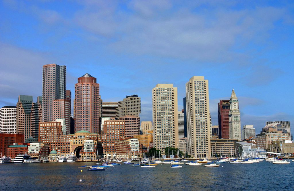
- Boston waterfront image: EgorovaSvetlana, Boston Waterfront Skyline View from Fan Pier Park, CC BY-SA 4.0, Wikimedia Commons. Image source
- Rockport image: John Phelan, Motif Number 1, Rockport MA, CC BY-SA 4.0, Wikimedia Commons. Image source
- Race Point image: m01229, Race Point Beach – Cape Cod National Seashore, CC BY 2.0, Wikimedia Commons. Image source
Road-status note: “CURRENT STATUS NOT INDEPENDENTLY VERIFIED” is intentional where a static article cannot guarantee conditions for a specific departure minute. The article directs readers to the official live road and park-status sources instead.