New England Road Trip Itinerary
Road Blueprint • 7-Days New England Road Trip guide
A seven-day New England road trip is long enough to experience several of the region’s defining landscapes, but short enough that every unnecessary detour can cost you valuable time. The trick is not simply choosing where to go. It is choosing how you want to travel between those places.
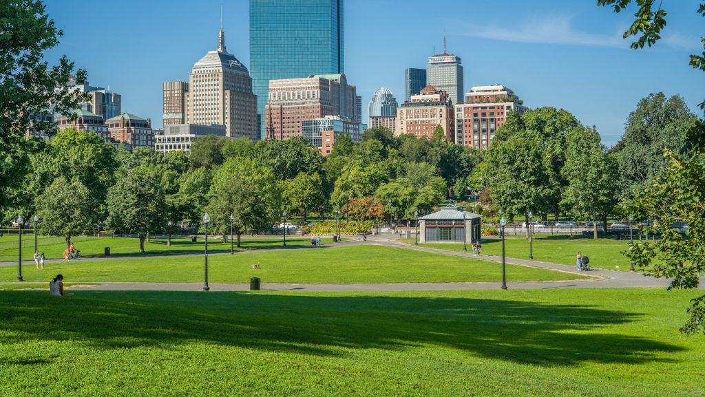
For this itinerary, Boston is the practical starting and finishing point. From there, the route moves north through coastal Maine, spends a full day around Acadia National Park, crosses into New Hampshire for the White Mountains, continues into Vermont, and then returns to Boston. That creates a road-trip loop with a clear geographic logic instead of a string of disconnected destinations.
The itinerary below gives you three ways to make the journey: a faster interstate-focused version, a balanced coast-to-mountain loop, and a slower all-New-England scenic concept. The central seven-day plan follows the balanced option because it leaves room for both driving and actual time outside the vehicle.
Key Points: Your Main Route Choices
New England looks compact on a map, but the experience changes dramatically depending on whether you prioritize highways, coastal roads, mountain scenery, or small-town backroads. These three route concepts give you a clear starting point before the day-by-day itinerary begins.
The Interstate Explorer Corridor
This version prioritizes the major interstate corridors between Boston, Maine and New Hampshire. It is built around reducing transfer time so you can spend more hours at your chosen destinations.


The Classic Coast-to-Mountain Loop
This is the main RoadBlueprint itinerary. It combines the Maine coast, Acadia National Park, the White Mountains, and Vermont while keeping the number of major hotel moves under control.
Live Road Logistics & Status
New England 511 combines current road information for Maine, New Hampshire and Vermont, including traffic conditions, incidents, closures, roadwork, restrictions, cameras, weather information and route alerts.
Check Live Work Zones & Detours →Massachusetts travelers should also check MassDOT’s official traffic and travel information before the Boston leg of the journey, while destination-specific roads and attractions should be checked with their responsible authority.
The Six-State All-New-England Scenic Byway
This is the ambitious version for travelers who want the road itself to be the attraction. It uses secondary highways, coastal routes and mountain corridors to connect Massachusetts, Rhode Island, Connecticut, Vermont, New Hampshire and Maine.
Planning-distance note: the route totals above are itinerary planning estimates, not fixed road measurements. Exact mileage and driving time vary with your selected hotels, stops, road conditions, traffic, and navigation choices.
The RoadBlueprint Love / Family Scorecard
These metrics are editorial planning tools rather than objective ratings. They are intended to show how the pacing of each route fits different travel styles.
| Route Category | ❤️ Love & Romance | 👨👩👧👦 Family Reunion | 😊 Happy Kids | 🤝 Finding Friends |
|---|---|---|---|---|
| Fastest Route | 3/10 | 5/10 | 4/10 | 5/10 |
| Moderately Fast Loop | 9/10 | 8/10 | 8/10 | 7/10 |
| Slowest Scenic Route | 7/10 | 4/10 | 3/10 | 6/10 |
Massachusetts travelers should also check the Commonwealth’s official road-information system before the Boston leg of the journey, while destination-specific roads and attractions should be checked with their responsible authority.
The 7-Day On-the-Road Journey: Route 2
This is the balanced version of the trip: Boston to the Maine coast, onward to Acadia, west into New Hampshire’s White Mountains, then through Vermont before returning to Boston. The point is not to drive every famous road. The point is to make each move serve the next day.
Boston to the Maine Coast
Start in Boston and head north toward Maine. The first day works best as a positioning day: make useful progress, take a meaningful break, and arrive in southern or central coastal Maine with enough energy to continue toward your overnight base.
Planning target: Reach your Maine overnight area without turning Day 1 into an all-day race.
Acadia National Park: Coast, Forest and Cadillac Mountain
Day 2 is intentionally based around Acadia rather than another long hotel transfer. Park Loop Road is 27 miles (43 km) and connects major areas including Sand Beach, Otter Point, Jordan Pond and Cadillac Mountain.
The National Park Service says Cadillac vehicle reservations are sold in advance, reservations do not assign a specific parking space, and vehicles longer than 21 feet, recreational vehicles and trailers are prohibited on Cadillac Summit Road.
Check Official Cadillac Reservations →Suggested rhythm: start early, drive the Park Loop Road, choose a few major stops rather than all of them, and return to Bar Harbor or your Mount Desert Island base for the evening.
Bar Harbor to the White Mountains
Leave the Maine coast and head inland toward New Hampshire. The purpose of this day is to reposition for the mountains without exhausting the group before the main scenic-driving day.
Cruising the Kancamagus Highway
Give the White Mountains a full scenic-driving day. The Kancamagus Highway, Route 112, runs approximately 34.5 miles through the White Mountain National Forest. Visit New Hampshire also describes a broader White Mountain scenic loop of about 142 miles, with several route variations.
The larger White Mountain route network also allows you to combine the Kancamagus with Franconia Notch, Crawford Notch, Route 3 or other regional scenic corridors depending on weather and daylight.
The Notch Gorges and High Peaks
Use the morning for another White Mountains experience before beginning the transition toward Vermont. Franconia Notch provides a compact mountain corridor where several attractions can be combined without crossing half the state between each stop.
Into Green Mountain Country
Vermont changes the character of the journey. Instead of the sharper granite scenery of the White Mountains, the roads begin to move through valleys, farms, forests, villages and mountain passes.
Vermont Tourism highlights the state’s scenic byways as routes through historic downtowns, farms, farm stands, covered bridges and mountain passes. The state’s designated Scenic Route 100 Byway stretches for about 146 miles, while the Green Mountain Byway connects routes around Waterbury, Stowe and nearby communities.
Classic Vermont Roads Back to Boston
Your final driving day should give you a choice rather than a rigid sequence. Leave Stowe early enough to enjoy one or two Vermont stops, then return toward Boston using the fastest practical corridor for your final destination.
Final-day strategy: return to Boston with a buffer rather than planning a long scenic drive immediately before an airport departure.
How Much Driving Should You Expect?
This itinerary is a genuine road trip. Some days are scenic-driving days and others are transfer days. Exact driving time will vary with traffic, weather, roadwork, hotel location and the number of stops you make.
| Day | Driving Character | RoadBlueprint Strategy |
|---|---|---|
| Day 1 | Long transfer | Reach coastal Maine without exhausting the group. |
| Day 2 | Local / scenic | Prioritize Acadia rather than mileage. |
| Day 3 | Long transfer | Move inland and protect the evening. |
| Day 4 | Scenic | Slow down and allow for viewpoints. |
| Day 5 | Mixed | Combine mountain scenery with the Vermont transfer. |
| Day 6 | Moderate | Experience Vermont without overpacking the day. |
| Day 7 | Long return | Use scenic roads selectively, then prioritize the return schedule. |
On-the-Road Traveler Logic: Mount Washington
If You Stop Here
You turn the White Mountains section into a major destination experience rather than simply a scenic transfer. The attraction can occupy several hours once you account for arrival, parking, waiting, tickets and the experience itself.
If You Skip It
You preserve more time for the Kancamagus Highway, Franconia Notch, short hikes, village stops or the onward Vermont drive.
Weather matters here. Mountain conditions can be substantially different from conditions in nearby towns, so check the latest official information before committing the day.
Route Deep Dives
Route 1: The Interstate Explorer Corridor
The Strategic Mission: Use the major highway network to reduce transitional driving and protect destination time.
Fastest Route Quick-Facts
- Planning distance: ≈350 miles
- Car driving: ≈6–7 hours active transit
- Primary strength: efficient intercity movement
- Main trade-off: fewer scenic secondary-road experiences
This approach makes sense when your real priority is the destination itself. It is also the easier framework when your trip depends on fixed hotel, restaurant or event reservations.
Route 3: The Six-State All-New-England Scenic Byway
The Strategic Mission: Make the road itself part of the trip by connecting the six New England states through a deliberately slower sequence of scenic roads.
Scenic Byway Quick-Facts
- Planning distance: ≈680 miles
- Car driving: ≈16–18 hours active transit
- Primary strength: maximum geographic variety
- Main trade-off: substantially more time behind the wheel
Vermont’s official tourism information specifically highlights scenic routes, byways and backroads connecting historic downtowns, farms, waterfalls and covered bridges.
Tip: “…For drivers looking to extend their journey beyond New England’s borders into quieter national corridors, take a look at these Underrated Road Trips Across North America.”
When to Take This Road Trip
The same itinerary behaves differently across the seasons. The biggest variables are daylight, weather, crowd levels, seasonal road access and attraction schedules.
| Season | What Changes | Planning Focus |
|---|---|---|
| Spring | Some facilities and roads transition into the new season. | Check opening dates and current conditions. |
| Summer | Long days but higher demand at major destinations. | Book popular stays and check Acadia requirements. |
| Early Fall | Cooler weather and changing foliage. | Expect higher demand around popular foliage periods. |
| Late Fall / Winter | Shorter days and more possibility of seasonal restrictions. | Rebuild the itinerary around current road and weather conditions. |
Where to Stay Each Night
| Night | Base | Why It Works |
|---|---|---|
| 1 | Bar Harbor / Mount Desert Island | Positions you for Acadia. |
| 2 | Bar Harbor / Mount Desert Island | Avoids an unnecessary second hotel move. |
| 3 | White Mountains | Convenient for scenic mountain roads. |
| 4 | White Mountains | Keeps the scenic day flexible. |
| 5 | Stowe / nearby | Gives Vermont a meaningful overnight stop. |
| 6 | Boston | Creates a departure buffer. |
What to Book or Check Before You Leave
- Rental car appropriate for your group and luggage.
- Accommodation in the Bar Harbor / Mount Desert Island area.
- White Mountains accommodation.
- Stowe or nearby Vermont accommodation.
- Boston accommodation when necessary.
- Acadia National Park entrance pass.
- Cadillac Summit Road vehicle reservation when required.
- Any attraction with advance-ticket or timed-entry requirements.
- Live road conditions and weather immediately before departure.
How the Route Works for Different Travelers
Traveling with children
Reduce the number of attraction stops on transfer days and make the journey itself more comfortable. The two-night stays around Bar Harbor and the White Mountains reduce repeated packing, checking out and checking in.
Traveling as a couple
Leave room for spontaneous stops. A small town, roadside viewpoint, farm stand or short walk can fit naturally into the route without requiring a completely new destination.
First-time New England visitors
Seven days is not enough to see every major New England destination comfortably. This itinerary deliberately leaves Rhode Island, Connecticut, Cape Cod and several other regions for another trip instead of forcing everything into one week.
The Biggest Road-Trip Mistakes to Avoid
- Trying to visit everywhere. Geographic coverage can quickly become more important than enjoying the places you actually reach.
- Using road mileage as your only timing measure. Scenic routes accumulate time through stops, parking, slower curves and photographs.
- Ignoring parking. A short attraction can become a long stop when the parking area is full.
- Relying entirely on GPS. Temporary closures, construction and seasonal restrictions can change the practical route.
- Arriving at Cadillac Mountain without checking the reservation requirement. The Cadillac vehicle reservation is separate from the park entrance pass.
- Changing hotels every night. Strategic two-night bases make the trip easier on families and couples.
- Leaving the longest return drive until departure morning. A previous-night return to Boston creates a useful buffer.
Final Route Comparison Overview
| Route Choice | Best For | Distance | Car Pacing | Main Strategic Gain | Main Trade-Off |
|---|---|---|---|---|---|
| Fastest Corridor | Rigid schedules and efficient transfers. | ≈350 mi | 6–7 hr | More destination time. | Fewer scenic detours. |
| Moderately Fast Loop | First-time road trips with mixed interests. | ≈490 mi | 10–11 hr | Coast + mountains + Vermont. | More transfer planning. |
| Slowest Scenic Byway | Travelers who enjoy the road itself. | ≈680 mi | 16–18 hr | Maximum geographic variety. | More driving and less downtime. |
RoadBlueprint Travel Snapshot
Boston, Massachusetts
≈10–11 hours active driving across the itinerary.
Check official live road information before each major driving day.
Bar Harbor • White Mountains • Stowe • Boston
Frequently Asked Questions
Is seven days enough for a New England road trip?
Seven days is enough for a focused route. The key is limiting the number of regions you try to combine. This itinerary concentrates on Boston, coastal Maine, Acadia, the White Mountains and Vermont.
Where should I start the trip?
Boston works well as the starting and finishing point because it provides major transportation connections and creates a practical northern New England loop.
How long is Acadia’s Park Loop Road?
The National Park Service lists the Park Loop Road at 27 miles (43 km). It connects major areas of the eastern side of Mount Desert Island, including Sand Beach, Otter Point, Jordan Pond and Cadillac Mountain.
Do I need a reservation for Cadillac Mountain?
For 2026, a vehicle reservation is required to drive Cadillac Summit Road from May 20 through October 25. It is separate from the park entrance pass.
How long is the Kancamagus Highway?
The Kancamagus Highway is approximately 34.5 miles through the White Mountain National Forest. The wider White Mountains scenic loop described by Visit New Hampshire is approximately 142 miles, with several variations.
Should I include Vermont in a seven-day trip?
Vermont adds another landscape and a different style of scenic driving. It fits naturally after the White Mountains, especially when the return to Boston is planned carefully.
Can a large RV take Smugglers’ Notch in Vermont?
Vermont law prohibits single-frame motor vehicles over 40 feet and tractor units with attached trailers over 45 feet from operating on the Smugglers’ Notch segment of Route 108. Check official Vermont transportation information before using the route.
What should I check immediately before driving?
Check New England 511 for road conditions, closures, work zones, restrictions, cameras and weather information, then check destination-specific alerts from the responsible park or transportation authority.
Sources & Verification
The changeable parts of this itinerary are based on official government, park and tourism sources. Route totals and daily driving estimates remain itinerary-planning figures because the exact result depends on the chosen hotels, stops and live road conditions.
- National Park Service — Acadia National Park: Plan Your Visit
- National Park Service — Cadillac Summit Road Vehicle Reservations
- National Park Service — Park Loop Road
- National Park Service — Acadia Directions & Transportation
- New England 511 — Regional Road and Traffic Information
- Visit New Hampshire — White Mountain Scenic Drives
- Vermont Tourism — Scenic Drives
- Vermont Agency of Transportation — Scenic VT Route 108 / Smugglers’ Notch
References
- National Park Service. (2026) Acadia National Park: Plan your visit U.S. Department of the Interior.
- National Park Service. (2026). Cadillac Summit Road vehicle reservations U.S. Department of the Interior.
- National Park Service. (2026). Park Loop Road
U.S. Department of the Interior. - National Park Service. (2026). Directions & transportation U.S. Department of the Interior.
- New England 511. (2026).
Regional traffic and travel information - Visit New Hampshire. (2026). White Mountain scenic drives
- Vermont Tourism. (2026). Scenic drives and Vermont scenic byways
- Vermont Agency of Transportation. (2026).Scenic Vermont Route 108: Smugglers’ Notch
.
RoadBlueprint verification note: This article is designed as a planning framework, not a guarantee of road or attraction availability. Before departure, verify current road conditions, closures, weather, parking arrangements, reservations, opening hours, and vehicle restrictions with the relevant official authority.