The Best Underrated Road Trips in North America
NORTH AMERICA • HIDDEN-GEM ROAD TRIPS
Skip the famous road-trip roll call for a while. These quieter North American drives trade headline status for wide-open landscapes, unusual history, local character and the satisfying feeling that you found the road for yourself.
overview
Some road trips become famous because millions of people already know the name. Others earn their place on your map because the road itself keeps giving you reasons to stop. That second group is where this guide lives.
For this article, underrated is an editorial description, not a formal tourism ranking. The routes below are established scenic byways, national park drives or official travel itineraries that sit outside the usual North American road-trip shortlist while still offering strong scenery, culture, history or wildlife.
Tip: If you want to balance these quiet stretches with a broader regional journey, you can also check out our New England Road Trip Itinerary, or perhaps, you prefer a city getaway with your friends over a quiet scenic drive, check out our guide to the Top 5 Girl Trip Destinations in the US to find the perfect weekend base. Thank you. Continue reading.
7 Underrated Road Trips Worth Putting on the Map
Instead of assuming a single ideal road trip across North America, consider these seven distinct getaways. You can journey along western Newfoundland’s Viking Trail, traverse the high desert of Oregon, or explore the unique geological formations of Washington’s Ice Age Flood region. By the time you get to the final destination in North Dakota, you’ll likely leave behind any thoughts of crowded tourist hot spots.
1 — VIKING TRAIL, NEWFOUNDLAND & LABRADOR
Character: fjords, exposed geology, Viking history and long northern drives.
2 — OREGON OUTBACK, OREGON
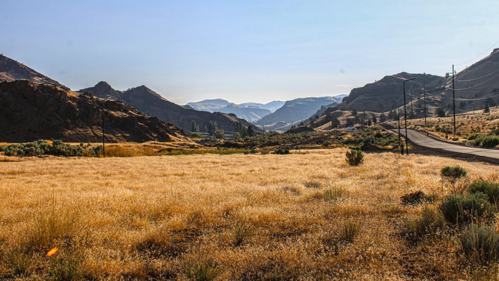
Character: high-desert geology, wide skies, sagebrush and the kind of road where the horizon does most of the talking.
3 — COULEE CORRIDOR, WASHINGTON
Character: Ice Age Flood geology, giant coulees, lakes, birding and Grand Coulee Dam.
4 — SANDHILLS JOURNEY, NEBRASKA
Character: rolling grass-covered dunes, open sky, small towns and extraordinary spring bird migration.
5 — COPPER COUNTRY TRAIL, MICHIGAN
Character: Lake Superior, copper-mining history, old towns, forests and four-season recreation.
6 — ST. JOHN VALLEY / FISH RIVER, MAINE
Character: Acadian and French-Canadian culture, river country, forests, farms and a very different Maine.
7 — THEODORE ROOSEVELT BADLANDS, NORTH DAKOTA
Character: badlands, wildlife, open prairie and a quieter national-park road experience in the North Unit.
Live Road Logistics: What to Check Before You Leave
These are road-trip planning guides, not live traffic feeds. Use Google Maps for departure-time routing and the relevant official road-information system before a long leg. In Maine, the state points travelers to 511maine.gov for current road information. In Oregon, Travel Oregon maintains travel alerts that include road closures and other travel impacts. Theodore Roosevelt National Park also advises checking current park and North Dakota road status because winter weather can close sections.
FUEL
Fill before a long rural leg rather than waiting for the warning light. Nebraska’s Sandhills Journey specifically notes that some communities have no fuel service.
OFFLINE MAPS
Download maps before entering the quieter corridors. Sandhills Journey notes that cell service can be limited in rural areas.
SEASONAL HOURS
Historic sites, museums, ferries and visitor facilities can run seasonal schedules. Check the official site before you build a day around one stop.
WEATHER
Do not interpret a clear morning as a full-day forecast. Long rural routes can cross changing weather zones.
View the 7 Routes on Google Maps
Use this map for broad geographic orientation. The route buttons above and within each detailed section open practical Google Maps directions for the individual drive.
The embedded map is for orientation. Google Maps should be used for your actual departure-time routing.


Route 1: Newfoundland’s Viking Trail
Newfoundland rewards the traveler who accepts that the drive is part of the attraction. Parks Canada’s current western Newfoundland itinerary connects Gros Morne National Park, L’Anse aux Meadows, Red Bay and Port au Choix over seven days, with distances that make this a proper road trip rather than a collection of nearby day trips.
7-day shape
Day 1: Arrive via Deer Lake or Port aux Basques, then drive toward Gros Morne.
Day 2: Western Brook Pond and Shallow Bay.
Day 3: Tablelands and a slower Gros Morne day.
Day 4: Long transfer north to L’Anse aux Meadows.
Day 5: Ferry to Red Bay, Labrador.
Day 6: Port au Choix, then back toward Gros Morne.
Day 7: Return to Deer Lake or Port aux Basques.
This sequence follows the structure of the current Parks Canada western Newfoundland itinerary; adjust around transport and seasonal operating information.
Route 2: Oregon Outback Scenic Byway
Travel Oregon describes the Oregon Outback as one of the state’s remote road-trip regions, with the 171-mile Outback Scenic Byway linking a huge high-desert landscape. Its official trip material highlights Fort Rock, Summer Lake, Lake Abert and the Abert Rim, where the scenery starts to feel almost more geological than scenic.
2-day shape
Day 1: Leave La Pine early, slow down around Fort Rock, then continue south through the open high desert.
Day 2: Give Summer Lake and Abert Rim the time they deserve before finishing toward Lakeview.
Travel Oregon’s current page was updated in July 2026 and still highlights the Outback as an off-the-grid road-trip option.
Route 3: Coulee Corridor Scenic Byway
The Coulee Corridor is a 150-mile National Scenic Byway built around one of North America’s strangest road-trip stories: massive Ice Age floods carved and reworked the basalt landscape. The official route description runs north-south through parts of SR 155, US 2 and SR 17, with Grand Coulee Dam, Banks Lake, Dry Falls, Soap Lake and multiple recreational areas along the way.
1–2 day shape
Day 1: Othello → Moses Lake → Soap Lake → Dry Falls → Coulee City.
Day 2: Continue toward Grand Coulee and north to Omak, adding stops according to daylight and interest.
The byway itself can be driven in about 3.5 hours, but the official description encourages using the corridor as a full day or longer experience.
Route 4: Sandhills Journey Scenic Byway
The Sandhills Journey is a 272-mile National Scenic Byway through Nebraska’s grass-stabilized sand dunes. The official byway site warns that some stretches are rural, services can be limited and cell coverage can vary. Its route guidance lists Grand Island, Ravenna, Broken Bow, Dunning, Halsey, Thedford, Mullen, Hyannis and Alliance as the principal sequence.
2–3 day shape
Day 1: Grand Island → Ravenna → Broken Bow.
Day 2: Broken Bow → Dunning → Thedford → Mullen.
Day 3: Mullen → Hyannis → Alliance, with extra time for wildlife, photography or local stops.
The byway’s own visitor information lists no-fuel communities and notes that cell service can be limited in rural areas.
Route 5: Copper Country Trail, Michigan
The Copper Country Trail is short by road-trip standards, but that is part of its charm. America’s Byways lists 47 miles from the Portage Lake Lift Bridge to Copper Harbor and notes that travelers can spend two to four days seeing the broader corridor. The byway is built around the Keweenaw’s copper-mining history, towns and natural scenery.
2-day shape
Day 1: Houghton → Hancock → Calumet, allowing room for historic sites and town walks.
Day 2: Continue to Copper Harbor, with a scenic spur or shoreline stop before returning or staying overnight.
The official Copper Country Trail site describes the region as a year-round recreation area with hiking, biking, paddling, winter activities and waterfall viewing.
Route 6: St. John Valley Cultural Byway / Fish River Scenic Byway
At the northeastern edge of Maine, the 134-mile St. John Valley Cultural Byway / Fish River Scenic Byway follows the rural valley beside New Brunswick and Québec. Federal Highway Administration material describes a corridor of small towns, farms, forests and a distinct culture shaped by Acadian and French-Canadian communities. MaineDOT’s original state byway description traces the cultural byway from Dickey through Fort Kent and Van Buren, with additional Fish River routing.
1–2 day shape
Day 1: Enter from western or central Maine, work toward Fort Kent and spend the afternoon in the valley communities.
Day 2: Continue east toward Van Buren and the Hamlin/Caswell area, adding the Fish River branch if time allows.
Maine’s foliage service typically identifies late September into early October as peak season in northern Maine, though actual conditions vary by year.
Route 7: Theodore Roosevelt National Park and the North Dakota Badlands
Theodore Roosevelt National Park’s North Unit is the quieter, more rugged side of the park, reached from U.S. Highway 85. NPS describes a 14-mile scenic road from the entrance to the end of the park road and notes that the North Unit sits about 50 miles from Interstate 94. The park’s South Unit adds a larger scenic loop near Medora.
2-day shape
Day 1: Enter the North Unit, drive the scenic road and spend time around the overlooks and short trails.
Day 2: Drive south toward Medora, then use the South Unit scenic loop if roads and daylight allow.
The park is open year-round, but NPS warns that snow and ice can close portions of park roads in winter.
The 7 Routes, Side by Side
This comparison is designed for trip planning, not for ranking the routes. The road that fits a three-day family break may not fit a week of remote scenery, and a short byway can still support several days of stops.
| Road Trip | Length | Drive baseline | Main character | Services / fuel | Best for |
|---|---|---|---|---|---|
| Viking Trail | 1,610–2,135 km roundtrip framework | Multi-day / long transfer | Fjords, geology, Viking history | Plan stops carefully around long distances | Big-scenery road trip |
| Oregon Outback | 171 mi / 275 km | Several hours + stops | High desert and geology | Rural / plan fuel | Quiet landscapes |
| Coulee Corridor | 150 mi / 241 km | ≈3.5 hr drive baseline | Ice Age Flood geology | Services clustered in towns | Families + geology |
| Sandhills Journey | 272 mi / 438 km | ≈4.5 hr drive baseline | Grass-covered dunes | Fuel gaps in rural stretches | Open-road reset |
| Copper Country | 47 mi / 76 km | ≈60 min one way | Mining history + Lake Superior | Town-based services | History + outdoors |
| St. John Valley | 134 mi / 216 km | 1–2 days works well | Acadian culture + river valley | Rural; plan ahead | Culture + slow travel |
| Theodore Roosevelt | North Unit 14 mi each way; South Unit ≈36 mi loop | 1–2 days in a park-centered trip | Badlands + wildlife | No park fuel; nearest services outside park units | Wildlife + family |
What You Will Enjoy — and What You Will Miss
More space to look around, smaller communities, unusual landscapes, slower mornings and the pleasure of having the road become part of the destination.
Major-city convenience, dense attraction clusters, easy same-day detours and the comfort of a famous itinerary that has already been planned by thousands of people.
That trade-off is the point. An underrated route often asks for more deliberate planning in exchange for a less predictable and more personal travel day.
Road Moments That Matter on Quiet Routes
FUEL BEFORE THE LONG LEG
On rural corridors, fuel is a planning decision. Nebraska’s Sandhills Journey provides a useful reminder that not every small community has a fuel stop.
DOWNLOAD BEFORE YOU LOSE SIGNAL
Save maps, addresses, reservation details and key phone numbers before leaving the stronger-service towns.
LEAVE ROOM FOR A REAL STOP
When the landscape changes dramatically, add time. A road trip is not improved by measuring every stop with a stopwatch.
PROTECT THE LAST HOUR
Do not casually turn daylight scenery into a night drive. A shorter final leg can make the evening far more enjoyable.
How Many Days Should You Give an Underrated Road Trip?
2 days: Choose the Oregon Outback, Coulee Corridor or a focused Theodore Roosevelt trip.
3 days: Sandhills Journey works better once you stop treating the road itself as dead time.
4–5 days: Copper Country and St. John Valley both become more interesting when you give local history and scenery room.
7 days: Western Newfoundland has the scale for a proper multi-day itinerary, and Parks Canada already provides a seven-day framework.
When Is the Best Time to Go?
There is no single season that works for all seven. Instead, match the timing to the route’s character. Northern destinations need more attention to winter access. High-desert drives can reward warm-season road conditions but still require weather checks. Wildlife and bird-focused trips may be better during migration windows.
For example, the Sandhills Journey site highlights the spring Sandhill Crane migration, while Maine’s official foliage information identifies the last week of September into the first week of October as the typical peak period for northern Maine, including the St. John Valley and Fish River drives. Copper Country promotes year-round recreation, and Theodore Roosevelt National Park remains open year-round with possible winter road closures.
RoadBlueprint Traveler Scorecards
Viking Trail
Oregon Outback
Coulee Corridor
Sandhills Journey
Copper Country
St. John Valley
Theodore Roosevelt
Practical Tips for Underrated Road Trips in North America
Start with the map, then build the day. Look at distances first. After that, decide which stops deserve actual time. A scenic road with six rushed stops is not a relaxing road trip.
Carry a second navigation option. Download offline maps and keep the official road-information link for the state or province you are in.
Refuel before the long leg. Rural routes often have fewer services than a city traveler expects. The Sandhills Journey visitor guidance is especially direct about fuel gaps.
Ask about seasonal operation. The road may be open when the attraction is not. Always check the official attraction or park page before leaving.
Keep children involved. Give younger travelers small missions: count wildlife, find unusual rock colors, spot historic buildings, photograph road signs or choose the next rest stop.
Leave some blank space. The best underrated road-trip moments often happen when nothing is scheduled for the next 30 minutes.
RoadBlueprint Travel Snapshot
Search intent: Underrated road trips in North America
Route style: Quiet scenic drives, rural corridors, national park roads, cultural byways and less-mainstream multi-day itineraries
Trip range: From a focused 47-mile byway to a multi-day 1,610–2,135 km Newfoundland framework
Best planning habit: Check official road conditions, opening hours, weather and fuel availability immediately before each long leg.
Core idea: An “underrated” road trip is often not hidden. It is simply a road fewer people put at the top of the list.
FAQ: Underrated Road Trips in North America
What counts as an underrated road trip?
Here, it means a route that sits outside the standard headline road-trip list but has established scenic, cultural, historical or wildlife value. It is an editorial description, not an official ranking.
Are these routes suitable for a family road trip?
Several are. Coulee Corridor, Sandhills Journey and Theodore Roosevelt offer particularly varied stop options. Newfoundland can also work very well for families when the long transfer days are planned honestly.
Which route needs the most planning?
The western Newfoundland route needs the most deliberate planning because of its long transfers, ferry element and seasonal visitor services.
Which route is the shortest?
The Copper Country Trail itself is 47 miles long, although the official byway guidance says travelers can spend two to four days exploring the wider corridor.
Do I need an SUV for these road trips?
Not automatically. Many of the featured roads are paved. Vehicle choice should follow your exact itinerary, weather, road restrictions and any off-main-road detours you add.
Can I use Google Maps alone?
Use Google Maps for routing, but do not treat it as a substitute for official road-status information, park alerts, ferry schedules or attraction opening hours.
What should I carry on a remote road trip?
Download maps, carry water, keep the fuel tank comfortably above empty, bring a basic first-aid kit, and save important addresses before you leave stronger cell coverage.
Are these roads open year-round?
Not necessarily in the same way. Some parks remain open year-round but can close roads during winter weather. Always check the current official conditions before departure.
Sources & Verification
Core factual route information was checked against current official sources on September 26, 2026. The source list below is intended for reader verification and future maintenance of the article.
- Parks Canada — Newfoundland’s West Coast Wonders
- Travel Oregon — Oregon’s Most Off-the-Grid Road Trips
- America’s Byways — Coulee Corridor Scenic Byway
- Sandhills Journey — Visitor Information
- America’s Byways — Copper Country Trail
- Copper Country Trail — Official Byway Site
- America’s Byways — St. John Valley Cultural Byway / Fish River Scenic Byway
- MaineDOT — St. John Valley Cultural Byway route history
- National Park Service — Theodore Roosevelt National Park North Unit
- National Park Service — Theodore Roosevelt National Park operating hours and seasons
- National Park Service — Theodore Roosevelt National Park directions
Image Credits & Licensing
- Route 431 / Tablelands, Newfoundland — Ryan Hodnett — CC BY-SA 4.0 — Wikimedia Commons source
- Abert Rim, Oregon — Orygun — CC BY-SA 4.0 — Wikimedia Commons source
- Grand Coulee Dam — U.S. National Archives / FHWA collection — Public domain — Wikimedia Commons source
- Sand Hills Road, Nebraska — Pfly — CC BY-SA 3.0 — Wikimedia Commons source
- Quincy Mine Hoist, Michigan — U.S. National Archives / FHWA collection — Public domain — Wikimedia Commons source
- Saint John River — Jared DenHollander — CC BY-SA 4.0 — Wikimedia Commons source
- Theodore Roosevelt National Park North Unit — Acroterion — CC BY-SA 4.0 — Wikimedia Commons source